
Radar painting revisited
-
A couple months ago I posted about concerns regarding the weather radar depiction. I finally had some time to quantify the expectation vs simulator.
for context I've simulated the beam of the radar in desmos: https://www.desmos.com/calculator/usvsrea3fa
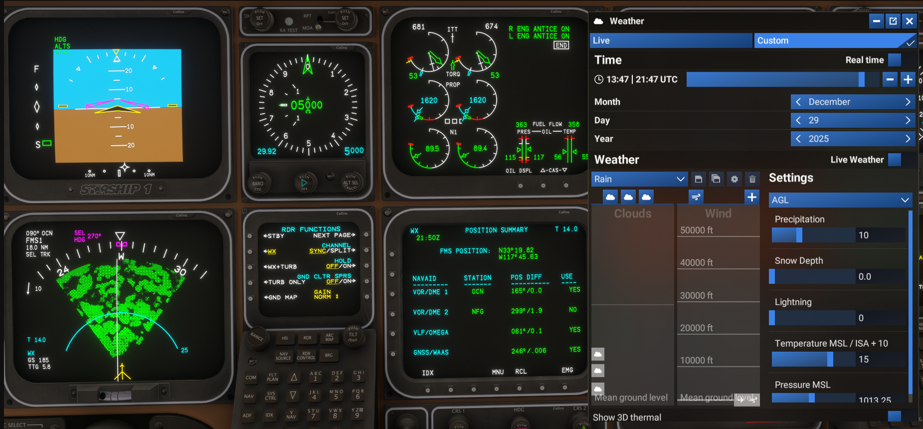
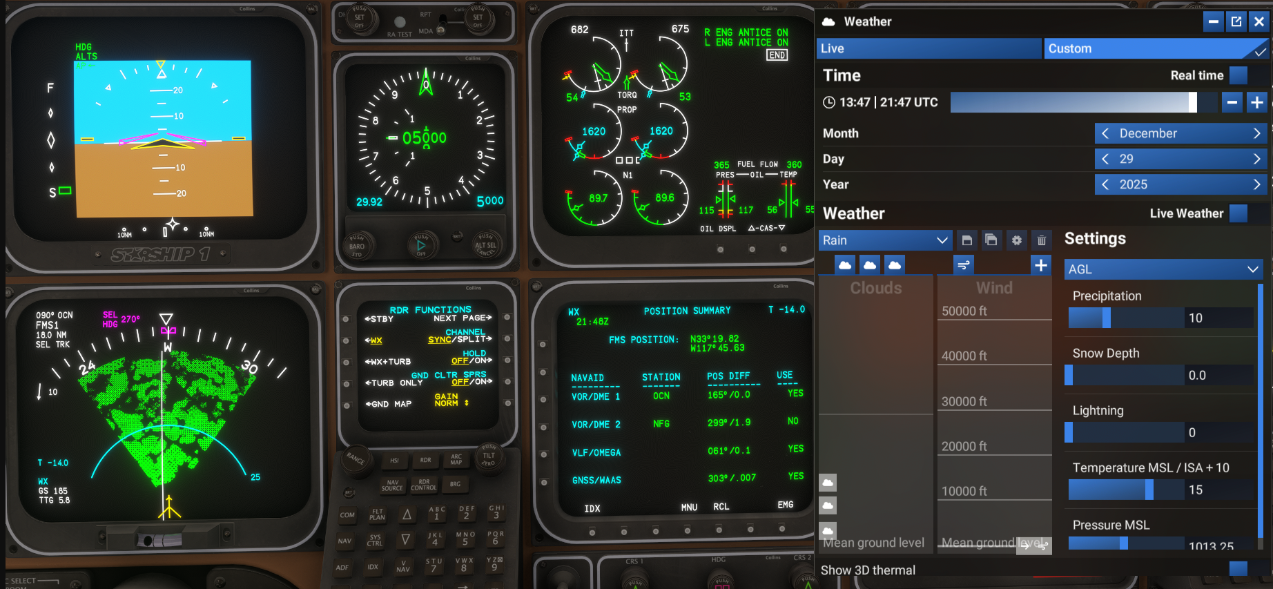
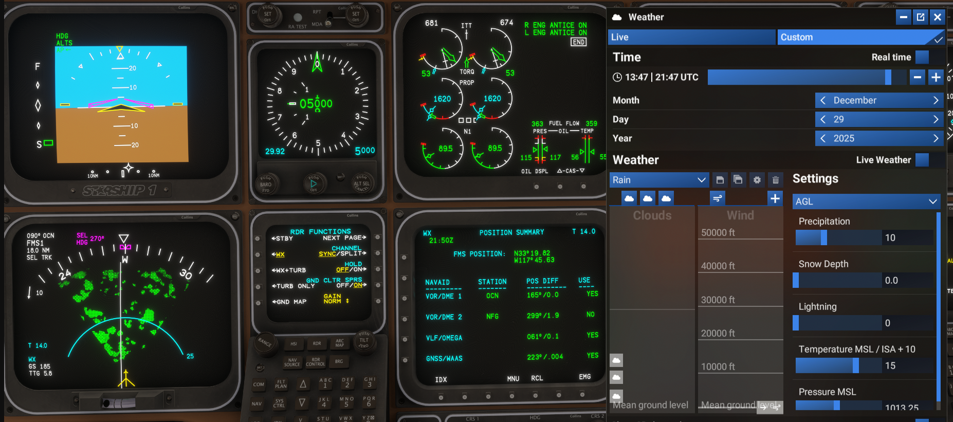
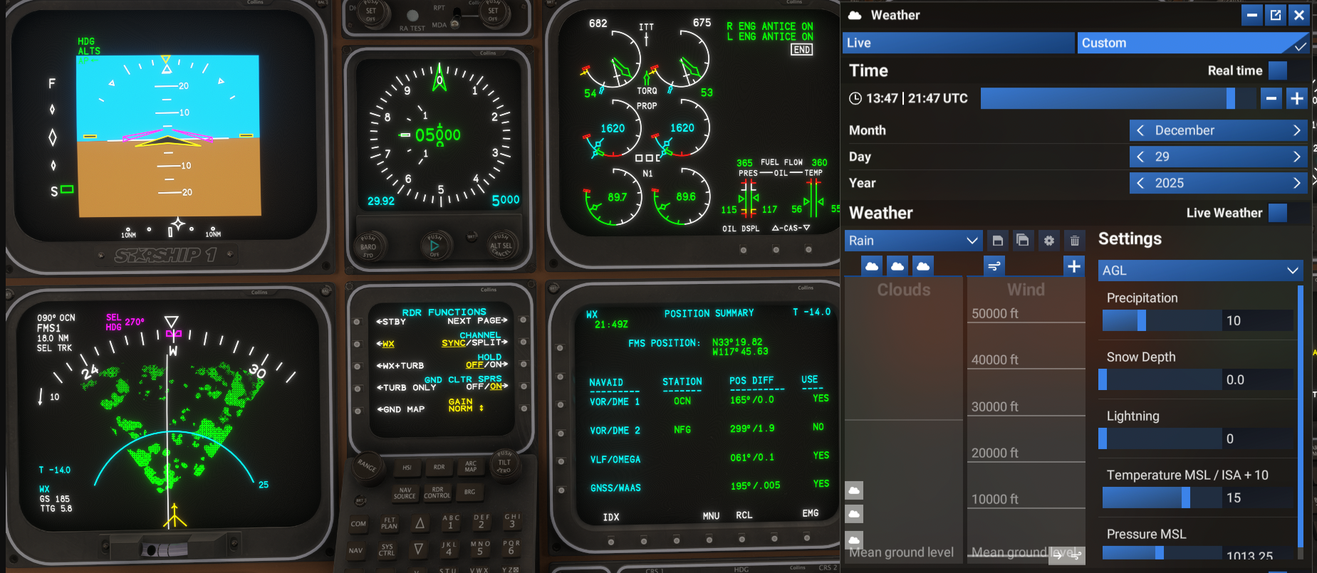
So here is the situation at hand, True altitude is 5000 feet (ISA STD SL). There is precipiatation and the radar is manipulated from +14° to -14° with GCS off and On. Cloud Tops are 18000feet and bases are 1500 feet. With the exception of a slight shader intensity change there is no difference in the presented image:GCS OFF
+14°
-14°
GCS ON
+14°
-14°
Here is why this is significant:
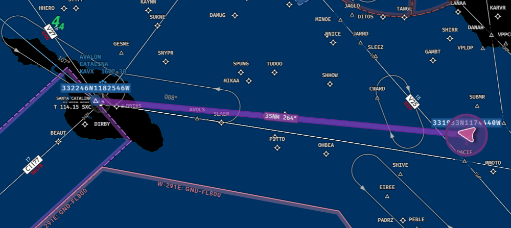
- At -14° Tilt and 5000 feet the radar should only paint distances between +2.61nm and +4.4nm
- At that location and heading, the only visible returns have a maximum elevation of +2100ft for Santa Catalina. But GCS is doing something very strange
- At +14° and 50nm the lower lobe is at 61,000feet and the upper lobe is almost 101,000 feet
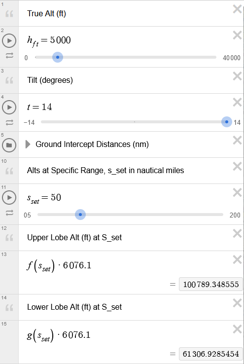
So there is nothing to paint at those ranges - With the clouds set as they are (assuming precip all the way to the top of the cloud) then a tilt of -0.5° would be the maximum tilt to paint something at 20,000 feet and 50 miles
@Black-Square do you have any insight into what is going on here?
-
Hey @Black-Square just following up on this, I'm interested in your insight on the shader working in the background for the radar.
@ProfCrash I'm flattered that you have put so much effort into trying to reverse engineer what is going on here (Desmos is one of my favorite tools for developing my aircraft, and I frequently thank the friend who introduced me to it), but I'm afraid the depth and accuracy that you are imagining in MSFS's radar depiction is mostly lacking.
There is currently no access for developers into MSFS's weather engine, so I have done the best I can with the limited radar imagery that is available to us. The same goes for the terrain radar. As I call it in my videos, I have created a "useful depiction" of the terrain and precipitation in front of the aircraft by taking horizontal "slices" of the imagery based on the radar tilt, and then dithering the imagery to realistic distances (near and far) based on various radar settings and atmospheric conditions. This allows the user to realistically plan weather and terrain avoidance by varying the radar settings to develop a picture of the obstacles ahead, but it will not produce geometrically accurate conical sections, as you have found above. Hopefully, some day Asobo will provide either improved radar imagery for us, or access to the real-time weather data so that we can create our own radar solutions.
-
@ProfCrash I'm flattered that you have put so much effort into trying to reverse engineer what is going on here (Desmos is one of my favorite tools for developing my aircraft, and I frequently thank the friend who introduced me to it), but I'm afraid the depth and accuracy that you are imagining in MSFS's radar depiction is mostly lacking.
There is currently no access for developers into MSFS's weather engine, so I have done the best I can with the limited radar imagery that is available to us. The same goes for the terrain radar. As I call it in my videos, I have created a "useful depiction" of the terrain and precipitation in front of the aircraft by taking horizontal "slices" of the imagery based on the radar tilt, and then dithering the imagery to realistic distances (near and far) based on various radar settings and atmospheric conditions. This allows the user to realistically plan weather and terrain avoidance by varying the radar settings to develop a picture of the obstacles ahead, but it will not produce geometrically accurate conical sections, as you have found above. Hopefully, some day Asobo will provide either improved radar imagery for us, or access to the real-time weather data so that we can create our own radar solutions.
@Black-Square Thanks! I figured it was something along the lines of access to the api for the actual weather. Shame that Asobo/their weather provider dont have an api for that.