
Radar ground mapping
-
Hey All,
Im a bit confused as to why im not painting the terrain on the map using the GND MAP mode or even in WX with GCS off. See image below
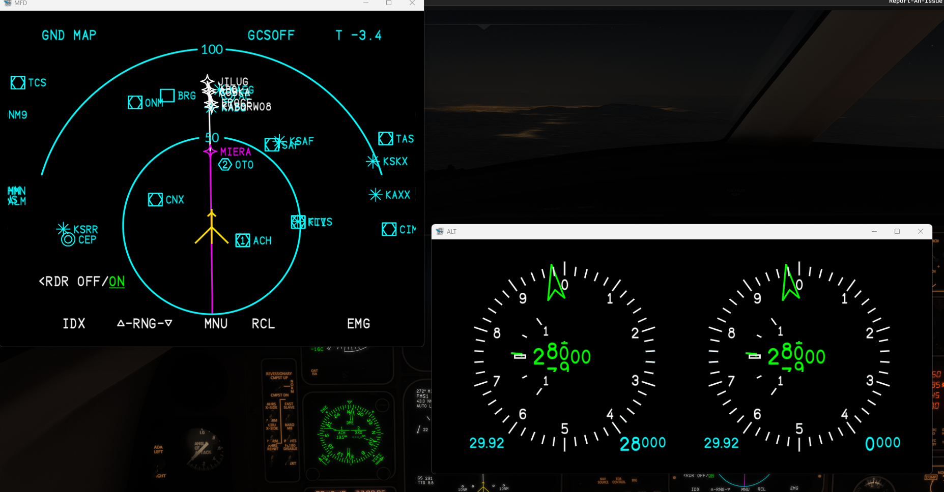
Those mountains are right next to KABQ (75nm from PPOS). KABQ elevation is 5300ft, those mountains hit 10000 on the right. Beam center should be at -3.2 degrees to paint KABQ but nothing is appearing. What am I missing?Thanks!
Crash -
I'm not sure what the cutoff is, but there is (from my experience) from pretty much all terrain maps a height above it at which point it will stop showing it.
So if those mountains top out at 10k, you're 18kft above it, so it won't show you anything. If you were some amount lower I believe it would start showing it.
-
Just have to "tilt" it down more.
It's tough to implement both wx and ground returns in MSFS - it isn't a precise radar simulation.
Think of it that you're moving a whole radar-plane directly below the aircraft vs. an actual radar transmission from the nose.
It'll show up eventually.
-
I checked again and ran the trig for different altitudes and was completely unable to paint the ground in MAP or WX mode regardless of the tilt. This seems like a shortcoming, I have on occasion at night with heavy rain tilted the radar down so the bottom of the beam catches ground at the edge of the display range. This helps identify a lower detection plane for the radar. For instance is I set the radar to paint the ground at 100 nm and the aircraft is ~30000ft AGL then at 50nm the bottom of the beam is 15000ft etc.
Every tilt from -1 to -12 resulted in a dark screen for trying to get any sort of ground return